Historic panoramic maps of American cities
A curated archive of American panoramic city maps, with historical notes, zoomable views, and archive-quality prints.
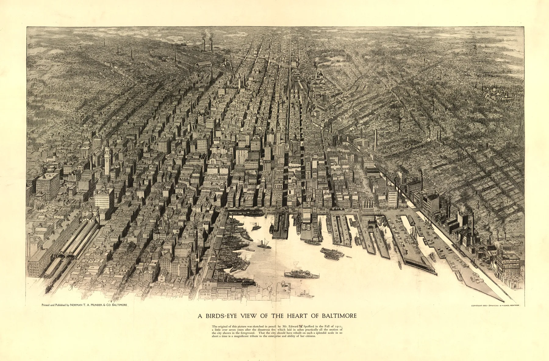
Explore the ArchiveBetween 1850 and 1920, artists climbed hills and imagined horizons to capture American cities at the height of their ambition. These panoramic maps, painstakingly detailed, commercially printed, and proudly displayed, are the sharpest portrait we have of a continent reshaping itself in real time.
Each map in this archive is sourced directly from the Library of Congress, carefully restored, and made available as a museum-quality fine art print. The original linework survives. The names of vanished neighbourhoods, long-demolished buildings, and forgotten wharves are still legible, waiting for someone to look again.
Browse by place, period, and maker
By state
Move through the archive by geography, from Maryland and Massachusetts to Georgia, Florida, and Minnesota.
BrowseBy era
Compare colonial plans, silver-boom towns, Gilded Age ports, and Progressive Era commercial centers.
BrowseBy theme
Move through the archive by visual type: harbor cities, transportation hubs, industrial centers, boomtowns, and more.
BrowseBy cartographer
Follow the artists, lithographers, and firms behind the city views rather than the cities alone.
ReadMap guides
Short reference pages that answer common search questions about bird's-eye views, the LOC collection, and choosing a print.
Read the archive by visual type
Harbor Cities
Panoramic maps where docks, basins, piers, and working waterfronts dominate the city's self-portrait.
ThemeTransportation Hubs
Maps organized around canal locks, ferry crossings, terminals, rail yards, and the infrastructure that kept people and freight moving.
ThemeIndustrial Cities
City views where furnaces, mills, warehouses, and reduction works shape the image as much as the street grid.
ThemeCoastal Cities
Atlantic and Gulf cities whose fortifications, wharves, and open water still control the composition.
8 cities live, more arriving.


Own a piece of this history
Every map is available as a fine art print, from classic matte posters to archival 250gsm fine art paper and stretched canvas. Printed and shipped from Europe. A certificate of archive provenance is included with every order.
Browse PrintsStart with the questions people actually search
How Panoramic Maps Were Made
How artists built panoramic city views from street-level observation, then turned them into lithographs before flight existed.
GuideHow We Restore Library of Congress Maps
How Meridian Prospect takes a Library of Congress scan and makes it readable on the wall without flattening the sheet itself.
GuideWhat Is a Bird's-Eye View Map?
What a bird's-eye view map is, how it differs from a street map, and what cities wanted these prints to do.
GuideHistoric Map Print Size Guide
How to size a dense panoramic map so the skyline reads from across the room and the details still reward a closer look.
GuideLibrary of Congress Panoramic Maps
Why the Library of Congress panoramic map collection matters, and how it anchors this archive.
GuideHow to Choose a Historic City Map Print
How to choose a city, era, and print format by memory, room, and the kind of map you want to live with.
GuideFine Art Paper vs Poster vs Canvas
How fine art paper, matte poster stock, and canvas change the feel of a historic map on the wall.