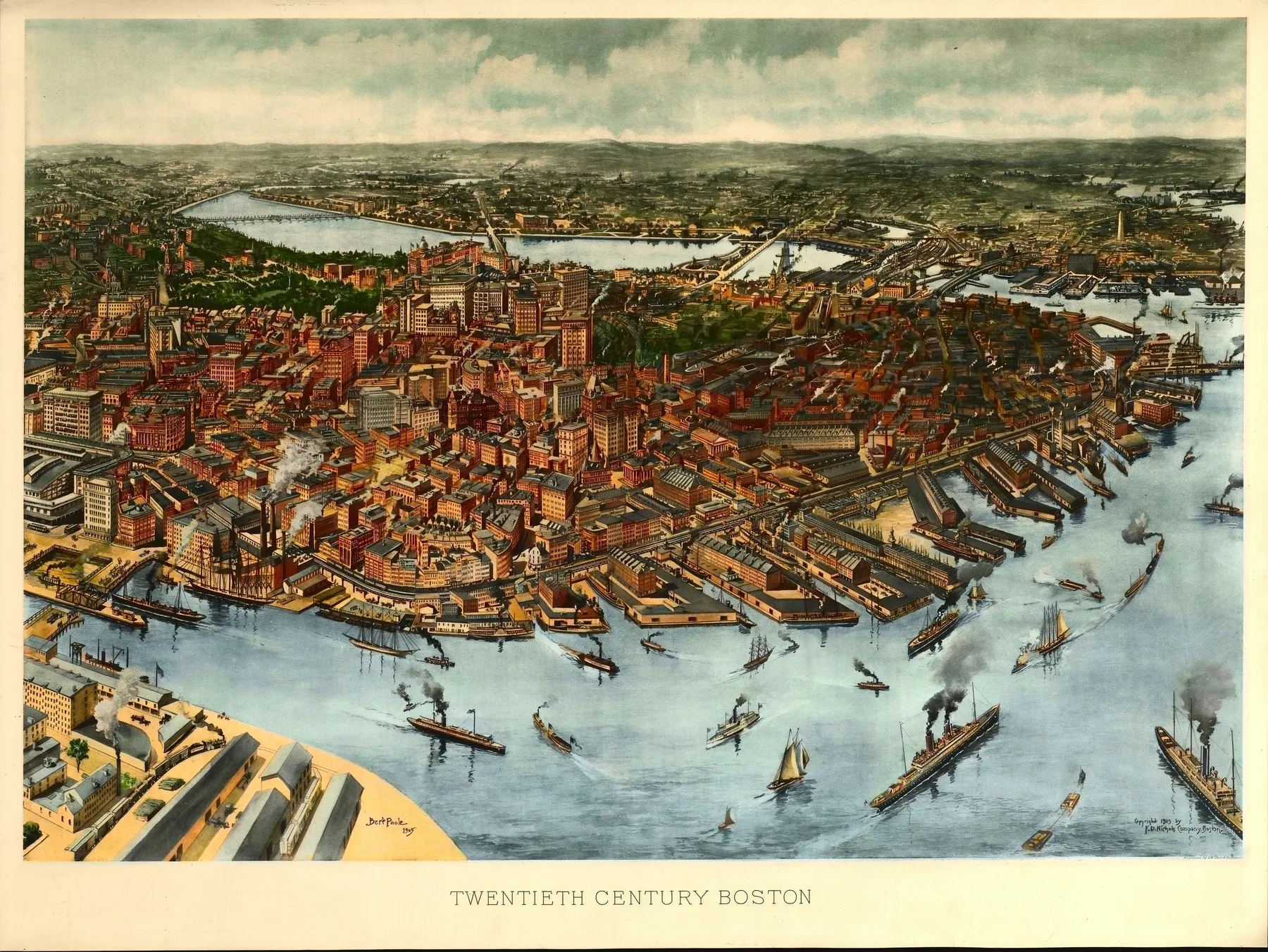
Coming in from the harbor in 1905, you wouldn’t have met Boston through its old stories first. You would have met it through smoke, whistles, and brick. Steamers crossed the foreground below a wall of piers, ferries cut across the slips, and the long sheds of South Station pressed against the waterfront behind them. The gold dome on Beacon Hill still stood where every visitor expected it, but from the water the city announced itself as a port that had learned to move people and freight at industrial speed.
By the 1900 census, Boston had 560,892 residents. That fixed it among the largest cities in the United States, but the stranger fact is how much of the city ran on infrastructure that still sounds modern. In 1897 the first subway line in the country opened under Tremont Street. Mass Moments notes that more than 100,000 riders took the short underground trip on its first day. Eight years later that tunnel belonged to a city where rail traffic met the harbor head on. Amtrak’s history of South Station notes that the terminal, completed in 1899, was the busiest in the country in its prime. Boston in 1905 was old in reputation and new in motion.
The ground under some of that motion had been made by hand. The Library of Congress’s own history of Boston land reclamation points out that Back Bay had been a tidal marsh before the filling plans of the 1850s turned it into one of the city’s largest expansion projects. By 1905 the brownstone grid west of the Public Garden looked settled and expensive, yet it rested on recent fill. That gives the city a useful tension. Boston liked to talk about inheritance, but one of its showpiece neighborhoods had been engineered into existence within living memory.
A. F. Poole drew Twentieth Century Boston with that argument in mind. The Library of Congress record credits Poole, F. D. Nichols Company, and A.W. Elson & Co., and the sheet gives the foreground to docks, train sheds, steam traffic, and the commercial core packed behind Atlantic Avenue. The Charles River and the filled land of Back Bay sit beyond the business district, not hidden, but treated as part of the same urban machine. Poole did not draw Boston as a colonial relic with a harbor attached. He drew a twentieth century city that still carried church spires and the State House dome, yet wanted the viewer to notice tunnels, terminals, and new land first.
That title was a claim as much as a description. In 1905 Boston still wore its old brick and old names, but Poole’s sheet insisted that the city had entered the new century through the harbor, the railhead, and the ground it had built for itself.
Themes
On the sheet
- Boston Harbor and inner islands
- Charles River and the Back Bay
- Beacon Hill
- South Boston and East Boston waterfronts


