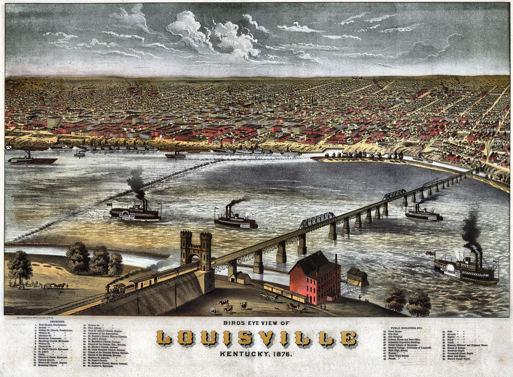
A traveler coming down the Ohio in 1876 did not drift past Louisville and decide whether to stop. The river made the decision first. At the Falls of the Ohio, a limestone shelf dropped the water twenty-six feet in two and a half miles, enough to break the easy run between Pittsburgh and the Mississippi. So the packet slowed, deckhands shifted freight, and passengers looked toward the wharf line and the canal works on the Kentucky side. They smelled wet timber and coal smoke before they knew the street plan.
By the nearest census, Louisville had roughly 124,000 residents. That made it one of the larger inland cities in the United States, but the figure matters less than the reason behind it. Congress had taken full jurisdiction over the Louisville and Portland Canal in 1874, and in 1875 Army engineers began the new lock and dam work that would reorder navigation on the Ohio. This 1876 panorama belongs to that moment. The city still owed its importance to a river obstacle, yet that obstacle was becoming federal infrastructure, measured, widened, and put under long-term control.
Louisville was doing more with those connections than moving cargo. The American Printing House for the Blind had been chartered here in 1858, and its own history explains why the institution took root in this city rather than somewhere on the Atlantic seaboard. Louisville’s railroad links and direct access to the Ohio made it a practical distribution point for raised-letter books sent across the South and West. By 1879, twenty-three of the nation’s thirty schools for the blind stood in those regions. That is a strange and telling Louisville fact. In the same year shown on this map, the young Kentucky Derby was only in its second season, with Vagrant winning the 1876 race on May 15. Louisville in these years was not only a transfer point. It had begun to advertise itself as a city of institutions and public spectacles.
Albert Ruger drew it that way. The Library of Congress record notes an index to points of interest, but the stronger argument lies in the composition itself. Ruger gave the Ohio River, the wharves, and the Portland Canal as much weight as the inland grid. Streets run back from the waterfront in long, orderly lines, while public buildings and depots declare that Louisville wanted to be read as more than a river landing. Yet the riverfront remains the controlling edge of the image. Ruger did not hide the fact that commerce, engineering, and geography still dictated the city’s shape.
That is what fixes the sheet so firmly in 1876. Louisville had not outgrown the falls that created it. It was still turning delay into profit, and then turning that profit into civic confidence, broad streets, and named institutions, all laid out beneath a mapmaker’s eye as if the river could be mastered because it had finally been measured.
Themes
On the sheet
- Ohio River and the Falls of the Ohio
- Portland Canal (bypass around the falls)
- Louisville waterfront wharves
- The city grid extending south from the river


