Coastal Cities city maps
These are the published city pages where the open Atlantic or Gulf edge still shapes the view. Harbors, forts, shipping lanes, and exposed waterfronts do as much work in the composition as the streets inland.
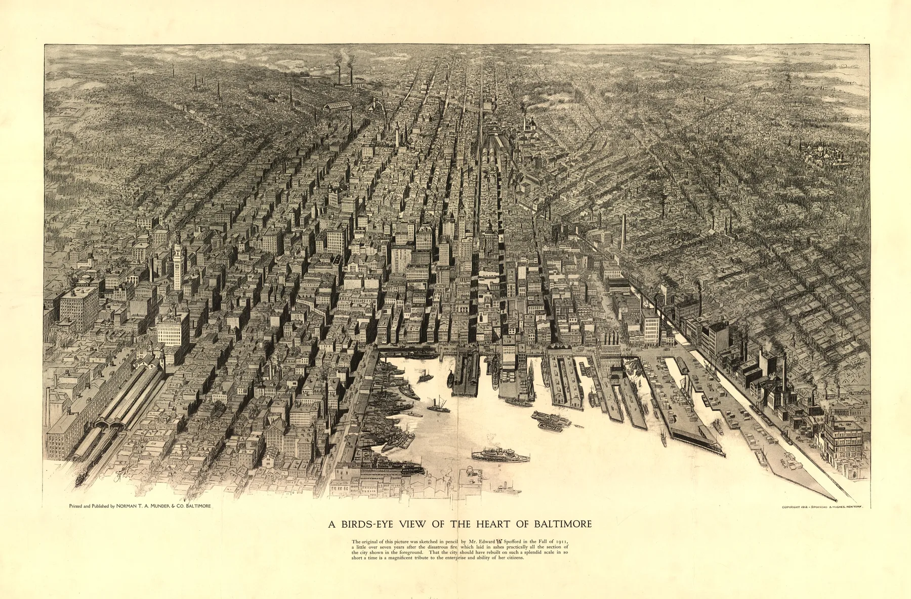
Coastal Cities becomes clearer when distant cities line up
Baltimore 1912, Boston 1905, and Savannah 1734 do not share one shoreline or one state line, yet the same structural problem keeps returning in the sheet. Atlantic and Gulf cities whose fortifications, wharves, and open water still control the composition.
Across 4 states, 3 eras, and 4 named maker groups, this page shows how one urban form can persist even when the dates, materials, and local economies change.


Florida
See how this theme appears in the Florida pages of the archive.
StateGeorgia
See how this theme appears in the Georgia pages of the archive.
StateMaryland
See how this theme appears in the Maryland pages of the archive.
EraColonial
See how the coastal cities sheets sit inside the Colonial portion of the archive.
EraGilded Age
See how the coastal cities sheets sit inside the Gilded Age portion of the archive.
EraProgressive Era
See how the coastal cities sheets sit inside the Progressive Era portion of the archive.