River Cities city maps
These maps gather cities whose commercial edge was fixed by a riverfront. The bluff, basin, canal, levee, or dock line is not background scenery here; it is the reason the streets, wharves, and public life arranged themselves as they did.
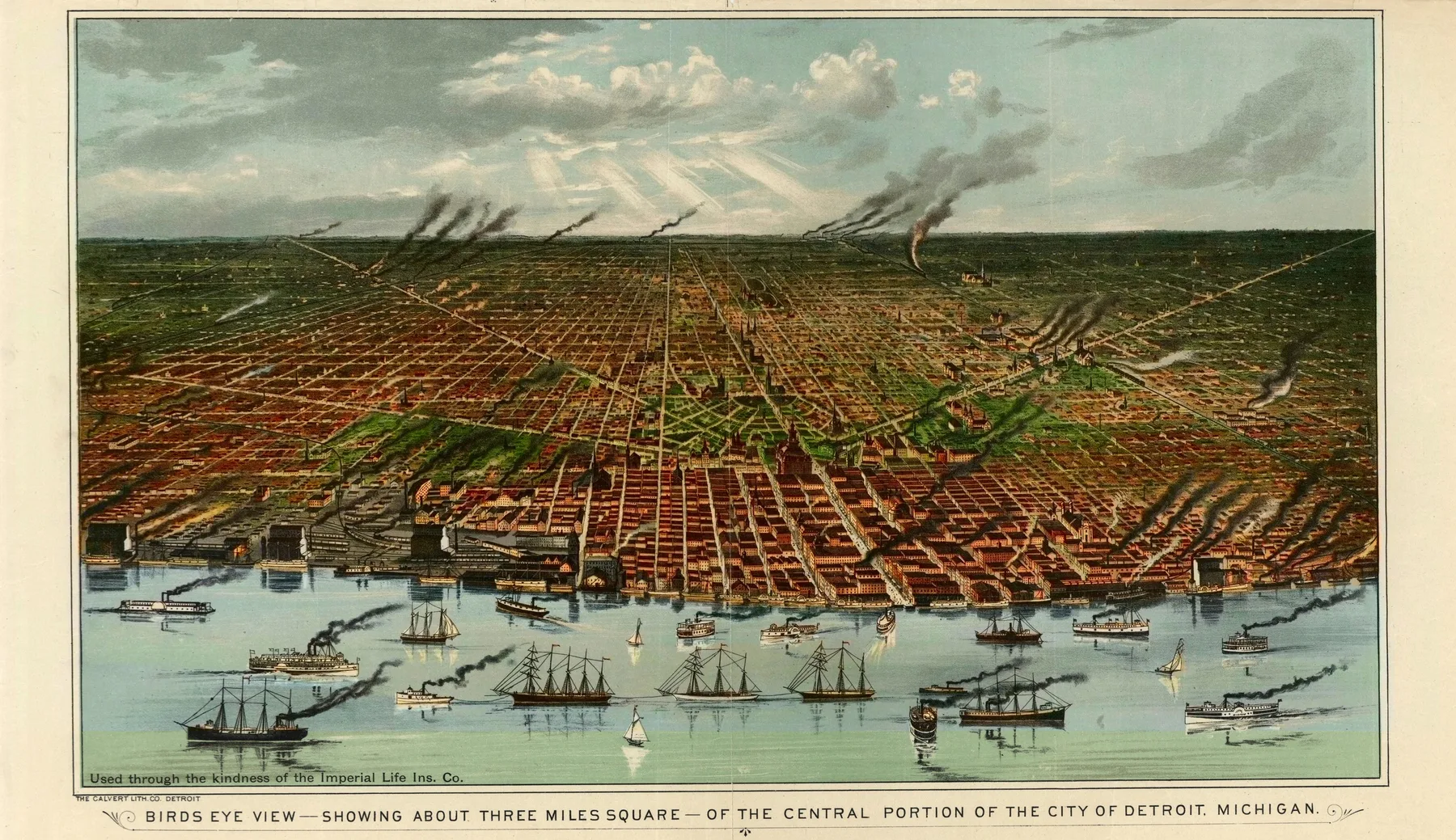
River Cities becomes clearer when distant cities line up
Detroit 1889, Louisville 1876, and Savannah 1734 do not share one shoreline or one state line, yet the same structural problem keeps returning in the sheet. Cities whose edge, commerce, and street logic were shaped by a river rather than an inland horizon.
Across 3 states, 3 eras, and 3 named maker groups, this page shows how one urban form can persist even when the dates, materials, and local economies change.


Georgia
See how this theme appears in the Georgia pages of the archive.
StateKentucky
See how this theme appears in the Kentucky pages of the archive.
StateMichigan
See how this theme appears in the Michigan pages of the archive.
EraColonial
See how the river cities sheets sit inside the Colonial portion of the archive.
EraGilded Age
See how the river cities sheets sit inside the Gilded Age portion of the archive.
EraReconstruction Era
See how the river cities sheets sit inside the Reconstruction Era portion of the archive.